Fun fact: If you live here, the tube and buses won't get you everywhere you need to be.
Other fun fact: I am notoriously bad with directions.
That second statement is not to be confused with "I get frustrated when I'm lost." As long as I don't have anywhere to be (hello, funemployment!), I don't mind getting lost and finding my way home again. I'm a very visual person so the more information I can put into my eyeballs the better I'll be. And I can still wander around — London is big enough; I'm not going to run out of discoveries any time soon.
Many modern-ish cities in the US are built on a grid system. It's wonderful. Some cities even number their streets, so that with a little background info you know which direction you're walking. Look at Minneapolis. Beautiful, structured Minneapolis. You could map eighth-grade algebra equations on this grid:
But oh, London. London makes directions very difficult. London adheres to no woman's grid system. You cannot tame London's catty-wonkus streets. It's like the first urban planner wanted to be the hipster of the 1400s: "I say, ol' chap, how about that street follow the river, and those other five can branch out from a random square —any square will do — but not at right angles. Right angles are so... predictable."
You think you're walking in a straight line? You aren't. This street curves ever-so-slightly and now you're off by about 45 degrees.
You think that street will take you all the way to your destination? NOPE. There's a private garden smack in the middle and you have to choose: veer left or right? Trick question: it doesn't matter. Neither street will behave how you expect.
You think those streets are right next to each other? And that you just have to cross the street to continue in the same direction? Nice try! Those streets are separated by a seven-foot-high, one-foot-wide stone wall, and there's a four-foot-wide stairway to get to the other side!
Can YOU see the tiny, grey walking path on the map below, right below the "ge" in "Bay Tree Cottage"? Me either! But it indicates that little passageway!
Now of course, at this point in human history every phone has a built-in map with a blue dot pulsing its location. However, not all of them have international data. Plus, I don't want to bump around this town with my face in my phone. I want to look up and around!
I've tried memorizing landmark-specific directions. "Past the park, three blocks, turn right." But I fail to take note of whether I counted three blocks INCLUDING alleys, or just streets?
I've tried noting street names. HA. In the following screenshot, you'll notice:
- Salisbury Place continues east, to be called Bickenhall.
- Crawford Street changes to Paddington Street (which is not close to Paddington Station, nor does it lead you there).
- Kenrick Place continues south, now named Broadstone Place.
- Google labels the yellow road as "A501" but as a pedestrian, you'd only see "Marylebone."
So, yeah. Good luck with that.
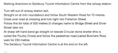
I do feel this might be an issue that UK residents are aware of, especially after receiving the following directions to meet up for my bike tour to Stonehenge.
It was pretty much a straight line:
 |
| "Just... don't turn until you see the info center." Centre. Whatever. |
So I'll take a bit of comfort knowing that I am not alone in this struggle, and that I have blissfully few places to be on any given day.
And I'll leave 20 minutes early. Because I will get lost.
Perhaps on purpose.


No comments:
Post a Comment